About
Leading international energy company Uniper owns the former Kingsnorth power station site and are responsible for bringing forward plans for its redevelopment.
Uniper also owns and operates Grain gas-fired power station, which is located on the Isle of Grain, this continues to make an important contribution to Britain’s energy supply security. Learn more about learn more about Uniper in the UK.
Site Location
MedwayOne is located approximately three miles east of the community of Hoo St Werburgh and approximately nine miles north east of the town of Chatham.
It is nine miles to Junction 1 of the M2 motorway, and just 18 miles from Junction 2 of the M25 motorway. The southern and eastern boundaries of the site are met by the mouth of the Medway River estuary, where there is a flood defence system in place. To the west of the site are a number of agricultural fields.
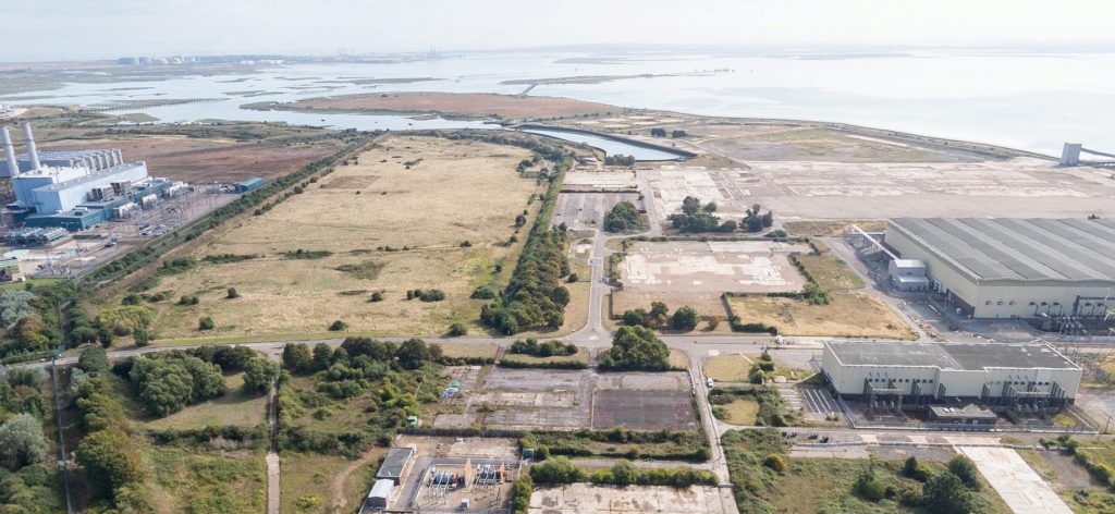
MedwayOne comprises mainly brownfield land, that was previously part of either the former coal-fired power station or the area of grassland to the north of the site, which was formally the RNAS Kingsnorth airfield. Access to the site would be via the entrance from Eshcol Road.
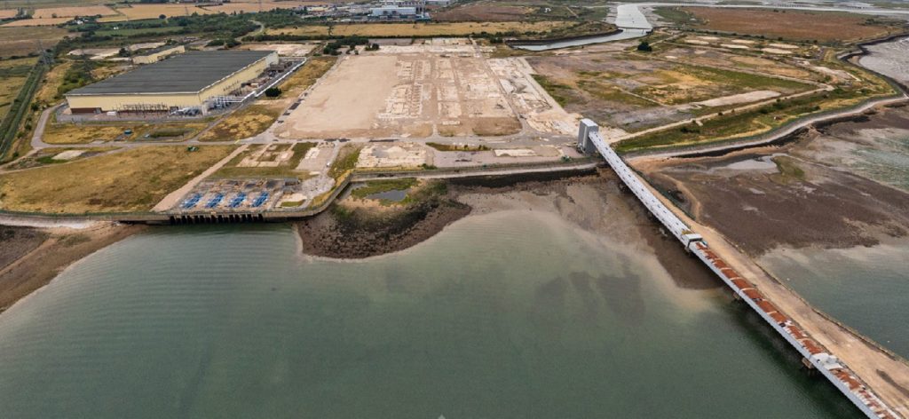
There are two jetties on the site, the first, Long Reach Jetty, which is a bespoke facility designed to move coal to serve the previous Kingsnorth power station. The Oakham Ness Jetty was built to supply oil to the now demolished Grain A power station. The jetties are not part of the planning consent, however, the MedwayOne masterplan has been specifically designed to maintain access to them - enabling their possible reuse in the future. Any reuse of the jetties would be subject to a separate planning applicationn.
Site History
The site is the former home of First World War naval airship station, Royal Naval Air Service (RNAS) Kingsnorth.
RNAS Kingsnorth was notably involved in the development of various non rigid airships during the First World War. After the closure of the site in the 1920s, the huge airship sheds were used as wood-pulping factories. The last aircraft shed was dismantled around 1938.
The site was mostly dormant until 1963 when construction of the power station began. Construction was completed in 1973 by the Central Electricity Generating Board (CEGB). Kingsnorth was the only dual-fired power station in Great Britain and was capable of producing up to 2000MW - enough electricity to power over 1.5 million homes and businesses. It was the largest of its type in Europe, designed to run on both oil and coal, but ran mostly on coal throughout its life. The power station's chimney, which removed steam and other gases from the plant's five boilers, was a prominent local landmark, standing at 200m against the Kent skyline - twice the height of Big Ben.
The power station finally closed in December 2012 after meeting the threshold set by the Government's Large Combustion Plant Directive (LCPD), requiring power stations that did not meet emissions-reduction targets to close after generating for 20,000 hours from January 2008 or by the end of 2015, whichever came first.
A comprehensive demolition programme began in 2014. The demolition brought approximately 24,000 tons of concrete and steel, and 1.5 million bricks to the ground. Overall, the demolition of Kingsnorth produced 143,985 tonnes of material, of which 97.26% was recycled, with some reused as aggregates within the site. The demolition of the site was completed by the end of 2018. The only buildings retained onsite, are the existing National Grid substations, which lie outside of the proposed development area.
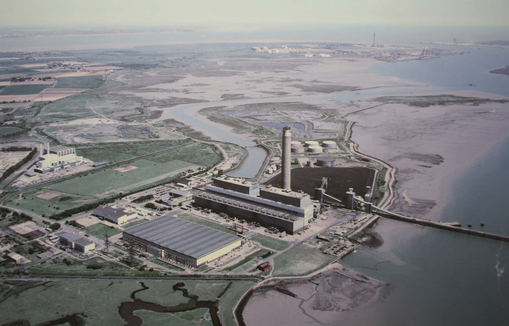
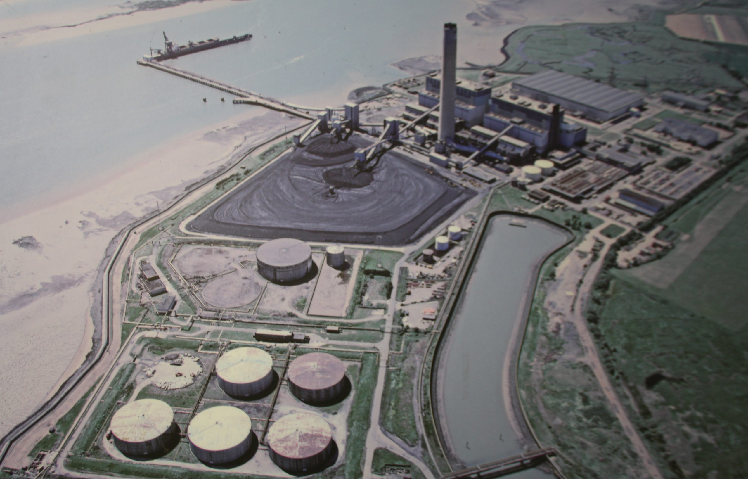
Historic images of the Kingsnorth Site